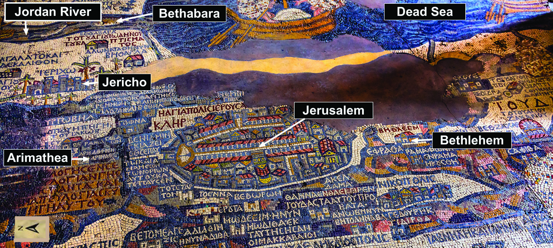
The Madaba Map is showing Palestine and the surrounding lands with amazing detail. It is also considered the oldest surviving original map of the Holy Land.
The map was made from many small colored stones called tesserae. It originally showed a wide region, from Lebanon in the north to the Nile Delta in the south, and from the Mediterranean Sea to the eastern desert. About 150 towns, villages, and biblical places were marked with Greek inscriptions.
The most famous part of the mosaic is Jerusalem, shown with streets, gates, churches, and important buildings. The map also shows Bethlehem, Jericho, the Jordan River, and many other places known from the Bible. Near the Jordan River, the map marks places connected with biblical memory, including the area traditionally associated with John the Baptist and baptism- Bethabara.
One of the interesting details is Arimathea, shown as a small village north of Jerusalem. This is important because the Gospels mention Joseph of Arimathea, the man who placed Jesus’ body in a new rock-cut tomb.
The Madaba Map is not only beautiful art. It is also a historical document. It helps us see how Christians in the 6th century understood the geography of the Bible. For pilgrims, it was like a sacred map of memory: a visual guide to the land of Jesus, the prophets, and the first Christians.
Today, the mosaic still speaks from the floor of St. George’s Church. Stone by stone, it preserves a Christian vision of the Holy Land — Jerusalem, Bethlehem, Jericho, the Jordan River, and the roads of biblical history.